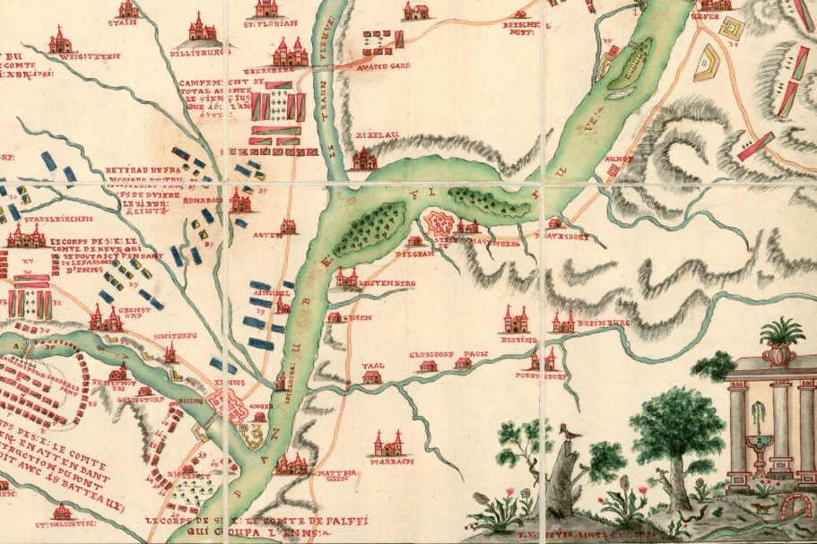
Map of Military Operations

We are pleased to share with you another fascinating item from the historical collections of the National Library of the Czech Republic. It is a map of military operations near Linz and Enns during the War of the Austrian Succession (62 A 246).

Dating: 1742
The hand-drawn historical military map is based on Charles de Feignet’s map Passage glorieux de la Rivière d’Enns fait par […] le Comte de Khevenhüller, published in 1742 in Vienna. It depicts the combat operations of the Austrian army under Count Ludwig Andreas von Khevenhüller (1683–1744 ) at the turn of 1741 and 1742 in the Upper Austrian region between Linz and Steyr. During the campaign, the Austrians quickly crossed the river Enns and laid siege to Linz (which capitulated on January 23, 1742).
The map is oriented with northwest at the top. The author of the manuscript copy, according to the inscription on the map, Lieutenant F. V. Peÿer, enriched the map with a representation of the successful siege of Linz, a drawing of part of the Linz fortification, and a remarkable parergon (graphic decoration), depicting a peculiar stylized scenery featuring a fountain, birds, and snakes. Lieutenant Peÿer himself is a mysterious person. Dozens of maps in Moll’s map collection in Brno are signed with his name (in various forms, but most often Geyer), and over 900 other sheets are attributed to him. However, his identification remains unclear.
Author of the text: Jan Vojtíšek


